August, 1993
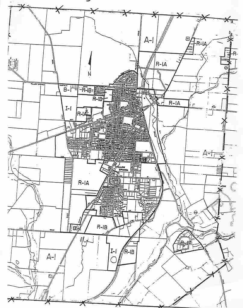
The concept of a planning impact area boundary grew out of the 1991-92 report* on land use involving both the Township and the Village. The identified Planning Impact Area Boundary (see attached map) indicates the area where any-development or significant change in land use is viewed as having an impact on the Village. It is also noted here that areas identified by the Wellhead Protection Commission as wellhead protection areas will be part of the Planning Impact Area.
A communication network will be developed between the Village, the Township and other County agencies regarding
proposed developments and their associated impacts within this area. The Village and the Township shall create
and utilize an open. ongoing dialogue regarding land use activity, particularly within this identified area. The
Village and Township working together on issues relating to land use is viewed as supportive of this approach.
Communication should involve sharing information on zoning and building permit applications and working with the
Greene County Regional Planning and Coordinating Commission on appropriate land use planning activities.
The Village will refer to the area depicted on the attached map in its land use planning and guideline documents,
the most important being the Village Land Use Plan.
* Growth Management Planning Study, July. 1992